A drive at the beginning of a walk...
As you navigate your surroundings, keep an eye out for unexpected discoveries. If you have a passion for art and culture, it's surprising how you may suddenly find yourself within an exhibition. Enjoy it when this happens.
Sculpture garden discovery
Remember to adjust your point of view, from overview to detail, high or low level. You never know when you will make discoveries. Try to 'notice' things.
Turning onto The Avenue
There are many nests in this tree, a whole community who have chosen to live in close proximity. At the moment they seem precarious and prominent, but by the time Summer comes around, they will be almost invisible.
Stark tree with many tenants
The Shaftesbury Avenue we walk along seems a million miles away from the West end of London. There are no theatres to be found and we are not close to either a Soho or Chinatown. What we do find, though, is a quiet, pleasant road that takes us north towards Street Lane.
Shaftesbury Avenue, but not a theatre in sight!
The ring road whisks vehicles across the north of Leeds, but as walkers we need to be alert to the many trails, bridleways and footpaths crisscrossing the landscape. These can be pathways for the current walk or targets for future walks.
The A6120 Ring Road traverses many footpaths
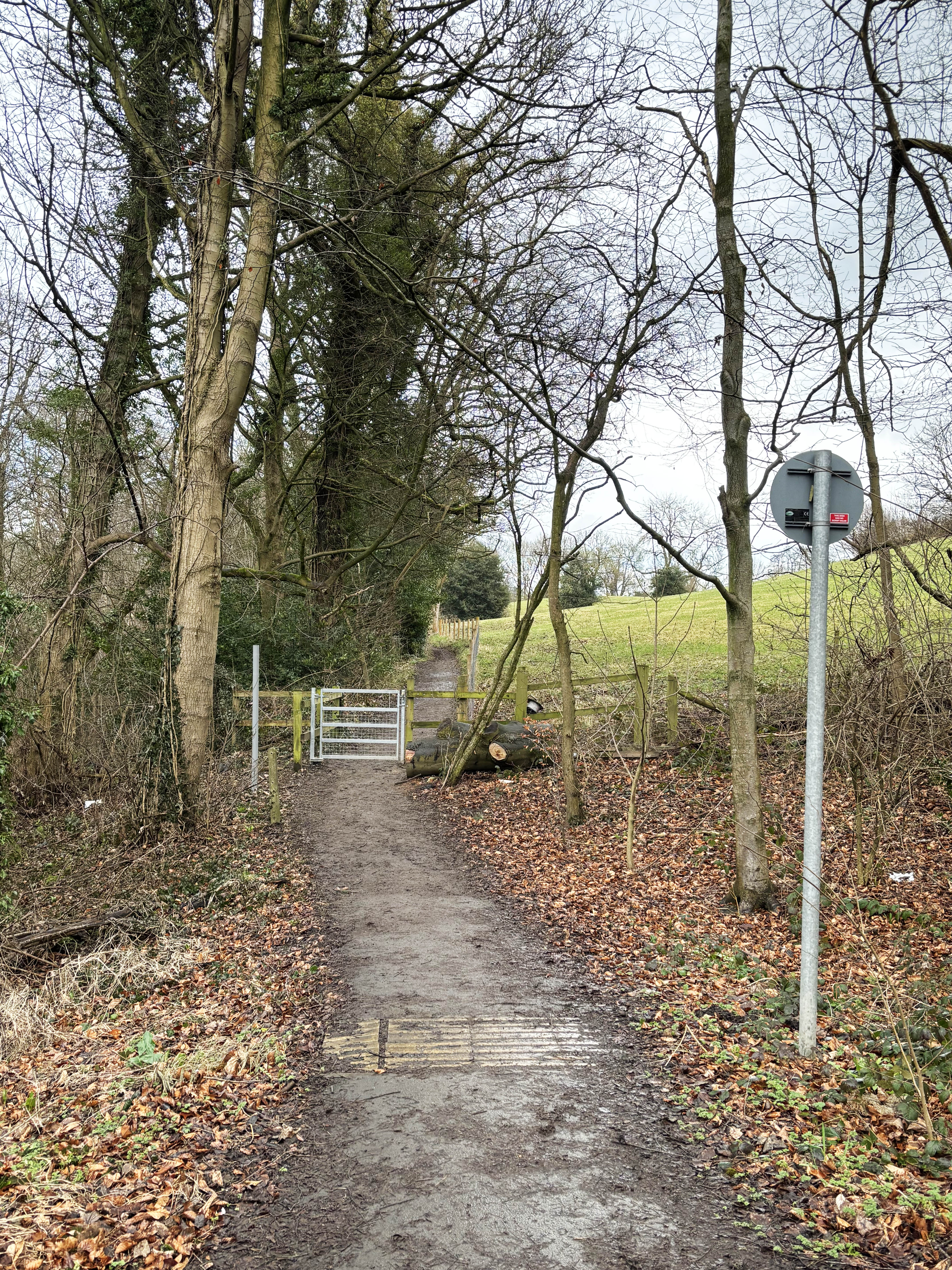
Footpaths take us to destinations that incorporate journeys through the countryside, that constantly change in character as the seasons change.
The footpath from Shadwell
During the walk, a junction point between several public bridleways was encountered along the ring road. It is at this point that the ring road is crossed. However, we didn't catch sight of any other walkers, cyclists or horseback riders.
Intersection of bridleways
At this point we approach a roundabout at the junction of the ring road and Wetherby Road. There was a time in the past when this area would have seemed outside of the city, but as houses have been built the city has expanded much further out.
The Ring Road junction with Wetherby Road
Seacroft was mentioned in the Domesday Book and was a village along the journey between Leeds and York, but later became one of the largest housing estates in the country. However, the village green still exists along with the associated pub, The Cricketers Arms.
A Seacroft welcome on Easterly Road
As the walk reaches the Wykebeck Valley, a sign indicates a green space running beside the beck that is called Arthur's Rein. It is thought that 'rein' derives from an old French word that indicates an area enclosed from stock. At some time it seems to have been named after the legendary King Arthur.
Joining Wykebeck Way at Arthur's Rein
The area along this section of Wykebeck Way has been laid out as a new area of housing, and at the present time appears pleasant and optimistic.
New housing along Wykebeck Way
Hetton Road leads uphill in a straight line, from Easterly Road towards Gipton Wood, crossing Arlington Road around half way up.
The top of Hetton Road, looking South South East
From the crest of the hill, on Copgrove Road, it is possible to see the tower of Parkinsons Building and the Emmanuel Centre (previously Emmanuel Anglian Church), both part of the University of Leeds.
Copgrove Road, looking across to Leeds University
and the Emmanuel Centre
Gipton Wood, a relatively small woodland area, covers the crest of the hill and needs to be traversed to return to Roundhay Road, just down from the Oakwood Clock. On the day of the walk, there were many birds and squirrels enjoying the sunshine.
Felled trees in Gipton Wood
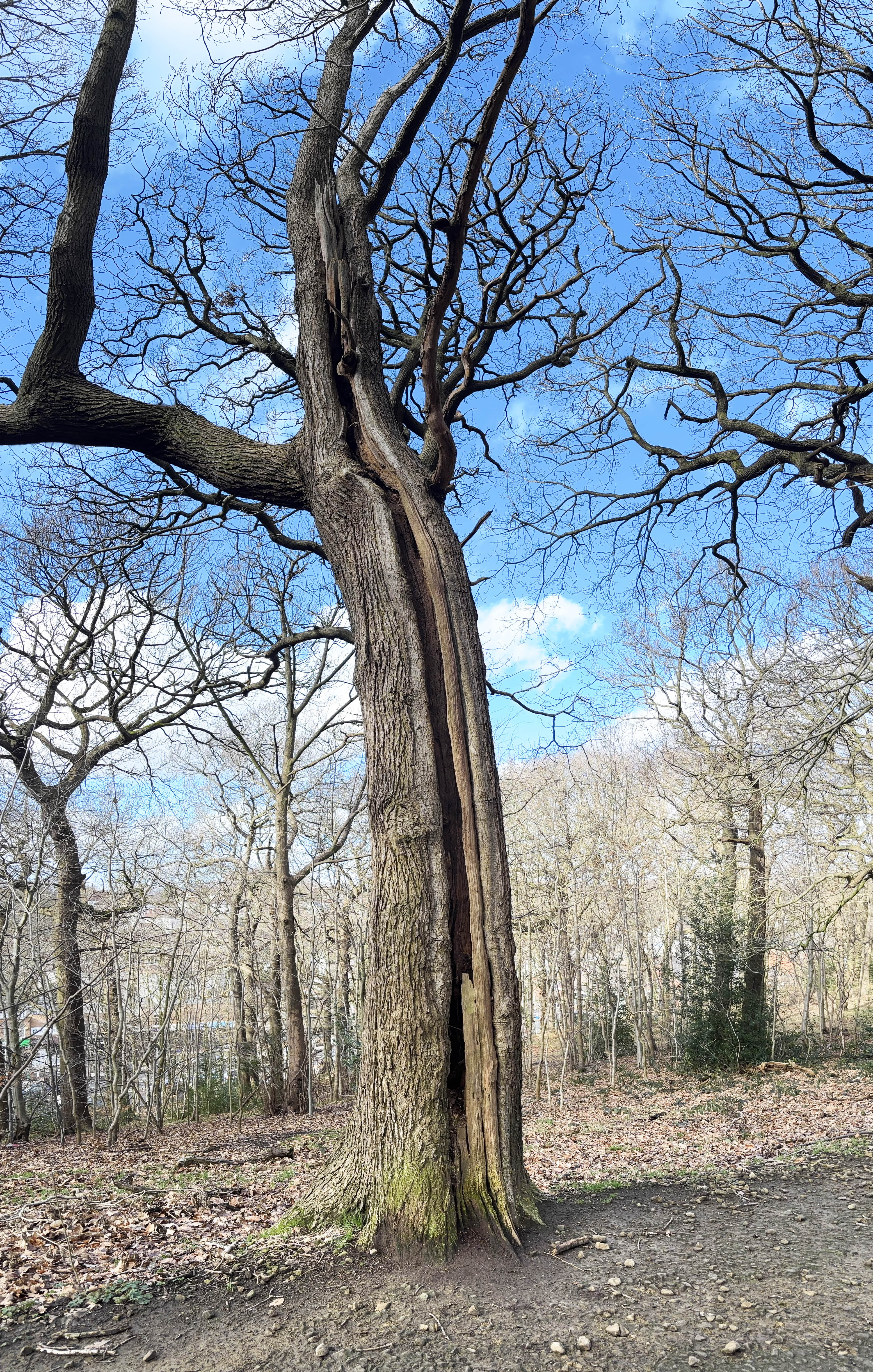
This particular tree stood alone, next to the footpath and non this warm, sunny day it appeared as though the tree was about to remove its winter coat and enjoy the sunshine.
Split bark tree in Gipton Wood
Gipton Wood is a triangular area of woodland, bounded by Copgrove Road on the south-east, Roundhay Road on the west and Gipton Boundary Road on the north-east side. This road still displays the old stone block work.
Out of Gipton Wood onto Oakwood Boundary Road
Another entrance to Gipton Wood is on Roundhay Road, a little further down from Oakwood Boundary Road and opposite the Roundhay Pub, which at one time was called The Gipton.
Gipton Wood entrance on Roundhay Road,
opposite the Roundhay Pub.
The fact that the old Roundhay hunting grounds gave rise to Roundhay Park (one of the largest in Europe) and that such a large part of the area was saved for the public's enjoyment should give rise to a great deal of hope for the future.
Apart from a couple of short periods of fairly light rain, the weather was great for walking and by the time we had reached Gipton Wood, the sun was shining down through the trees. Now, all thoughts turn to Terminalia 2026, and potential areas to explore.